- Writing proposal, estimating costs and managing budget
- Identifying, selecting and managing GIS staff
- Designing GPS data collection and GIS integration work plans
- Developing work flows and tools for processing and integrating field data
- Writing user documentation and technical memorandums for field and office activities
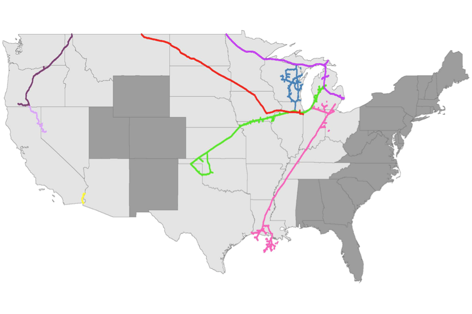
Capture and update information on businesses within High Consequence Areas (HCA) along approximately 15,000 miles of gas pipeline spanning 26 states in the United States.
Responsibilities included:
- ArcGIS for Desktop
- Trimble GPS Pathfinder Office
- Trimble TerraSync
- Python